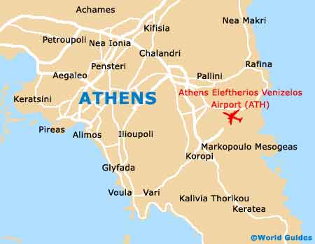
Athens International Airport (ATH)
Orientation and Maps
(Athens, Greece)
One of the most historic cities on the planet, Athens is full of ancient monuments and has a population of around four million people. The biggest city in the whole of Greece, Athens is also the capital city and host of the recent Summer Olympics, which were held in 2004. Athens is a spreading city and stands in the plain of Attica, featuring a number of imposing mountains in the background.
Located on the south-eastern side of central Athens you will find the Eleftherios Venizelos Airport (ATH), which has been directly responsible for much of the region's growth and expansion. Over the years, the city has absorbed many surrounding villages as it continues to grow.
Athens Eleftherios Venizelos Airport (ATH) Maps: Important City Districts
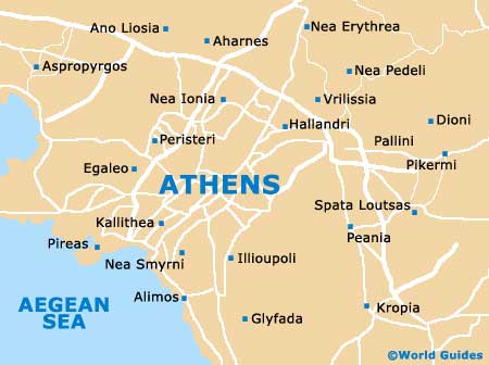
The very heart of Athens has become well pedestrianised, following the highly successful Olympic Games, and much of this area is best explored on foot. Buses are also available around the city centre and for those looking to travel further afield, there are two main train terminals in the city, the Larissis and Pelopónnisos stations. Both of these train stations are operated by the Hellenic Railways Organisation.
One of Europe's most famous historical structures, the Acropolis stands high above central Athens and is a helpful point of reference. Dating back approximately 2,500 years, the Acropolis is easy to reach and stands close to the Metro station, being just a short distance from the city centre.
Greece Map

Athens Map